Stephen Barlow
Tropical Meteorologist
TRACK FORECASTING
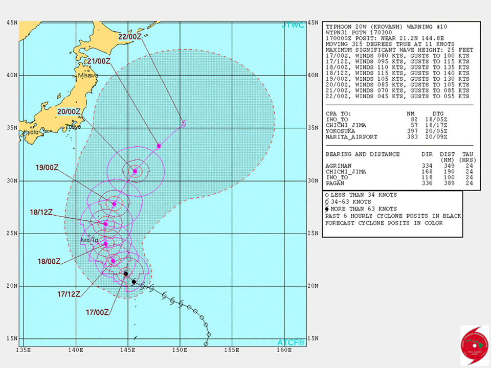
This image is an example of a typical typhoon warning product produced by the Joint Typhoon Warning Center. It shows a re-curve track where the system is gradually turning northeastward within the next 5 days.
http://www.usno.navy.mil/JTWC/
It shows the track forecast (pink solid line), wind radii (34-knot, 50-knot and 64-knot) for the main quadrants of the typhoon and 34-knot uncertainty area for the entire 5-day forecast (this is used by ships as an avoidance area).
There is more information on this product so go to the 'Warning Legend Info' link if you're interested in learning more about this product.
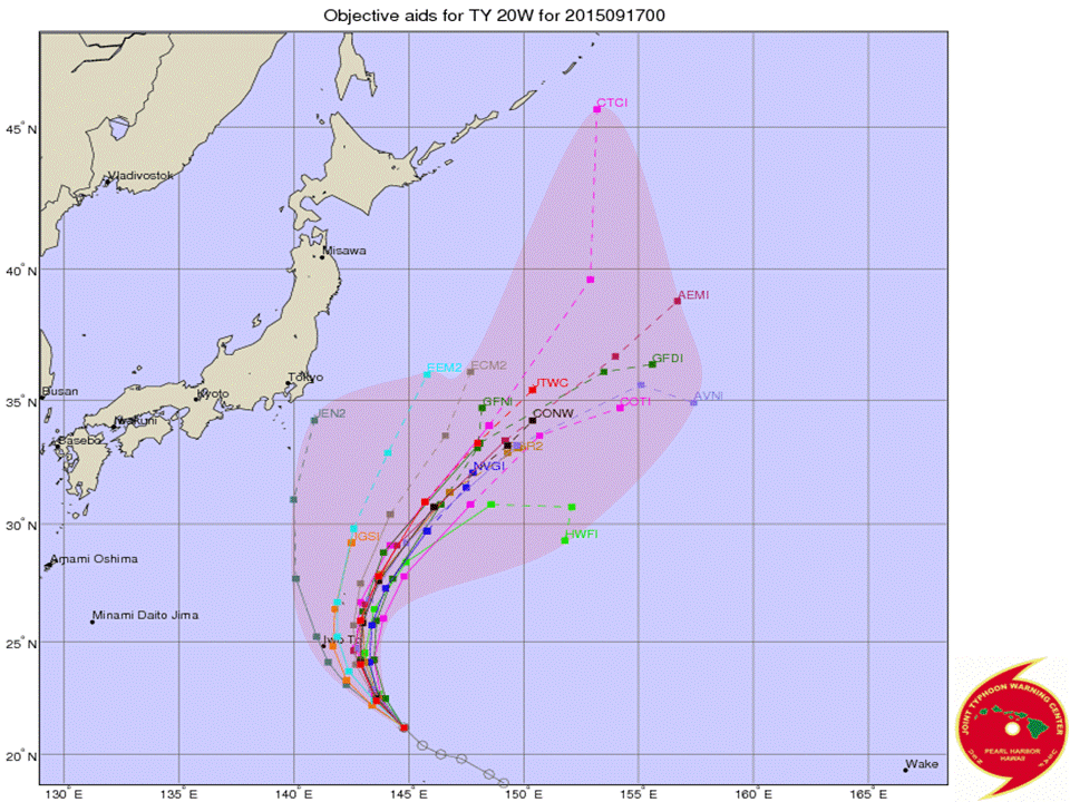
This product shows all the primary models that we use (basically the most accurate and consistent models). So each line represents a different model and represents the typhoon's center tracking through 5 days.
I highlighted what is called uncertainty with a red color-filled area. Every typhoon forecast has differing degrees of uncertainty, which are represented by the spread of the models. This uncertainty arises due to significant differences in how each model forecasts the evolving atmosphere e.g., each model will depict the strength and size of the typhoon differently, which will affect how it tracks. Additionally, there are differences in the shape of the steering highs and midlatitude troughs, which also impact the track.
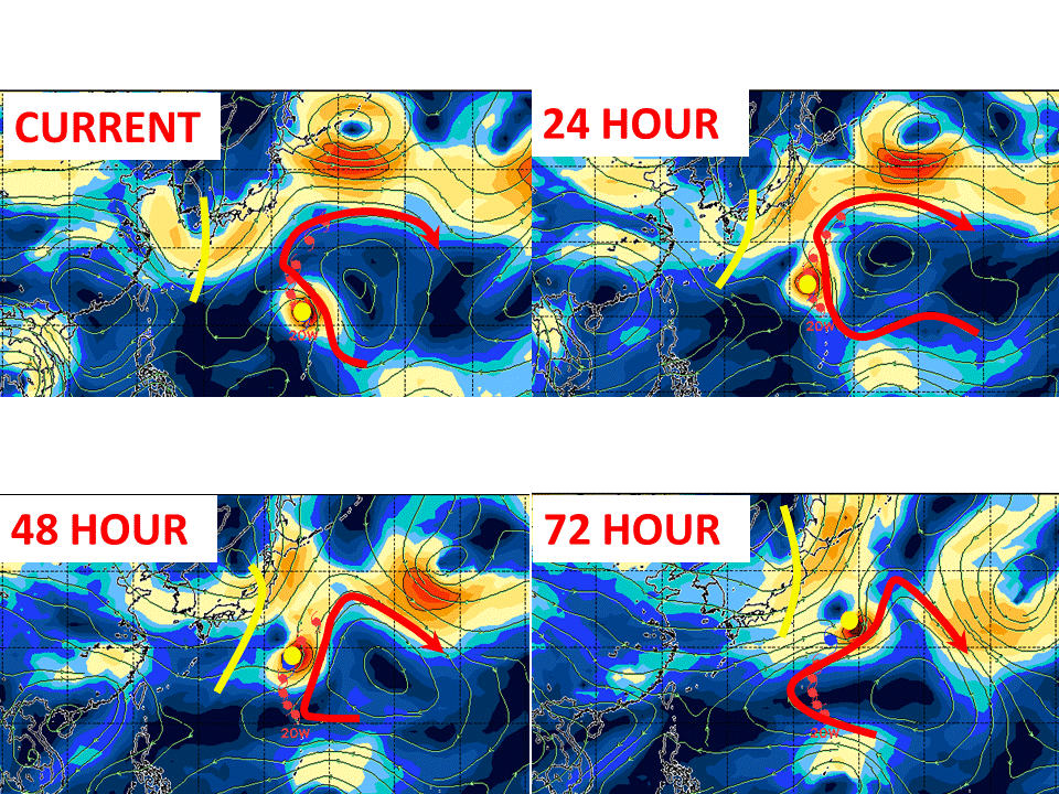
So what steers typhoons?
Highs steer typhoons. I drew red arrows on the chart to show the general flow of the high steering this typhoon.
The charts show the steering through a deep layer of the atmosphere and include the current chart (analysis) and the forecast charts at 24 hours, 48 hours and 72 hours.
You should be able to see how the shape of the high changes through time as a midlatitude trough (yellow line) moves east and the high weakens and re-orients. These charts are available at: