Stephen Barlow
Tropical Meteorologist
INTENSITY FORECASTING

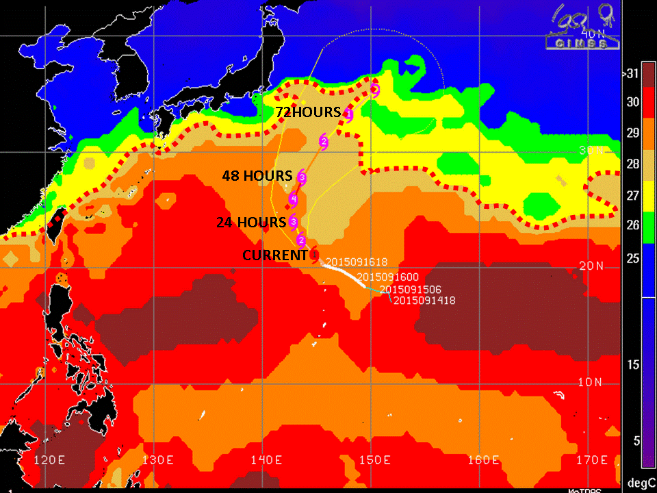
Go the CIMSS page and click on the system of interest. Change image resolution to 8km and click the SST (Reynolds) button. This will overlay the SST (sea surface temperature) over the latest JTWC forecast track.
SST is critical to typhoon intensification. Warm SST > 27 celsius is favorable. I highlighted the favorable SST with a red-dotted line. You can see that the typhoon is forecast to track over favorable SST until about 72 hours when it begins to track over the yellow and green SST (26 to 27 celsius). Unfavorable SST will serve to weaken a system (the cooler the more the impact) while favorable SST will serve to strengthen a typhoon. You can use this product to make your own assessments.
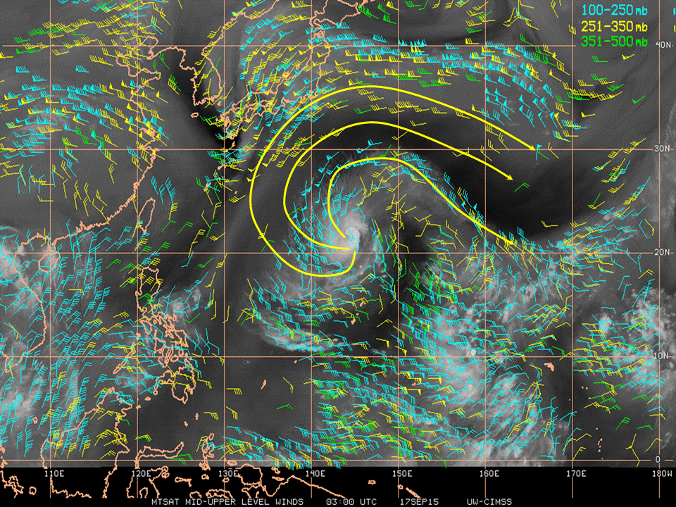
Upper-level winds (higher than 30,000 feet also can help or hinder typhoons.
This product shows wind vectors (direction flowing toward) and intensity of each wind (each long line is 10 knots, short line 5 knots and a triangle is 50 knots).
Upper-level flow is called outflow. A typhoon needs to breathe, much like a fire. If it doesn't have sufficient outflow, it will choke the typhoon and thereby weaken it.
Upper-level winds for this typhoon show strong poleward outflow. This allows the typhoon to strengthen. Lack of outflow will serve to weaken the system.
Another important influence of typhoons is vertical wind shear (VWS). VWS relates to the average wind flow from about 5000 feet to 30,000 feet. VWS can be favorable < 15 knots, or unfavorable > 15 knots.
Favorable VWS will support intensification. Unfavorable VWS will serve to weaken a typhoon by causing tilt. Typhoons have to be built vertically, if they are tilted, they can't strengthen. This is advanced dynamics so just understand the general thresholds.
Using the VWS Charts, which show the magnitude of the VWS (in yellow) and the direction of the VWS (brown line), you can assess whether VWS is favorable or unfavorable.